Posts

Showing posts with the label Elder Swamp

Love Thy Neighbor

Image
The men and women who settled in early Hanover County were an adventurous breed.  Life was full of challenges, as well as opportunities.  Neighbors were indispensable and often times became kin through the marriage of children.  One such marriage was the union between John R. Thurman and Judith Hooper. Thurmans and Hoopers The Thurmans and Hoopers lived in an area of Hanover County that fell within the boundaries of St. Paul's Parish.  Although the parish was connected to the Church of England and provided worship services for the parish's inhabitants, the parish was also charged with many civil duties, such as holding regular land processions to maintain an ongoing record of ever changing property boundaries.  It is from one such procession record that we learn the Thurman and Hooper families lived near, if not adjacent, to one another. The Thurman family had been processioning land in the same area of St. Paul's Parish, with the same surrounding land own...
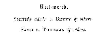
Betty in Forma Pauperis

Image
"There lived....a people who had the moral courage to stand up for their rights and thereby they injected a new meaning into the veins of history and of civilization."      ---------Dr. Martin Luther King Jr.  In 1835 Hanover County, Virginia, a woman simply named Betty filed suit in forma pauperis to fight for her and her children's liberties.  In a world where Betty had no rights under the bondage of slavery, the court abstract for Betty's suit presented a woman's fight to keep her family together.  What initially drew my eye to this suit was that somehow my Thurman family was involved Betty's battle.  I feared digging further into the suit and learning something about my Thurman that I really didn't want to know.  And yet, I couldn't get Betty and her brave heart out of my mind.  I had to know Betty's story and the fate of her children. According to the official court record , Betty was the property of William Gooch, a white, land...

What Happened to Mr. John White's Lands?

Image
In the previous post , the general locations of Mr. John White's four different tracts of land in St. Paul's Parish were identified.  Each tract was located in a distinctly different location within the parish.  So, what happened to these lands? 1731 Based upon the St. Paul's Parish Vestry Record, Mr. John White conveyed two of these tracts of land sometime between 1719 and 1731 to John White Jr. and Samuel White.  Unfortunately, there are no extant parish procession records or deeds between 1719 and 1731, so the actual year of these transactions cannot be confirmed.  But we do know that by 1731, John White Jr. was in possession of the land surrounding Beaverdam Creek in the Green Community, a nd Samuel White became the owner of the land in the Blue Community .  An analysis of what happened to John White Jr.'s land and Samuel White's land will be outlined in a future post. After Mr. John White transferred his lands in the Green and Blue Communities to...

Mr. John White Records 1695 to 1705

Image
1695 to 1705 Record Analysis for John White 1695 Court Order to Maintain Roadways The 1695 New Kent County Court order for Mr. John White is an excellent record.   It provides an honorific name to follow, as well as a specific geographical region within New Kent County.   More importantly, the time span from 1695 (original court order) to 1705 (confirmation of the court order) shows that Mr. John White had an interest in this geographical area for at least ten years.   Figure 1 illustrates an approximate boundary of the court order described area.   The boundary was drawn on an 1867 map of Hanover County r etrieved from the Library of Congress .  Figure 1 A  Represents the mouth of Elder Swamp at Chickahominy River B  Represents the unknown Little Creek, branch of Matadequin Creek C  Represents the approximate area for Pole Green Quarter D  Represents the mouth of Beaverdam Creek at Chickahominy River This geogr...