Posts

Showing posts with the label The Vestry Book of St. Paul's Parish

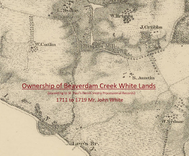
Mr. John White's Beaverdam Creek Land 1711 to 1784
Image
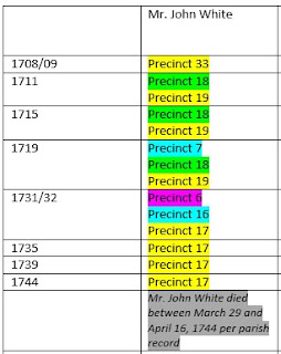
In an earlier post , we found that Mr. John White owned two pieces of land, 320 and 190 acres, according to the 1704 New Kent County Quit Rent roll.  And yet, there is no known record of how he obtained these properties.  The first known record of Mr. John White obtaining land was a 1705 land patent for 211 acres in New Kent County, on the east side of Beaverdam Creek.  It is probable that these 211 acres were across the creek from one of his other tracts (320 or 190 acres) that included the White Mill.  The only known existing records to track the ownership of Mr. John White's properties at Beaverdam Creek are the precinct processions of the St. Paul's Parish Vestry Record .  Although the precinct numbers changed over time, the surrounding land owners of Mr. John White's Beaverdam property stayed the same, allowing us to follow ownership changes .     Below is a visual chronology of the procession years and the responsible parties for the Beaverdam...
Mr. John White's Land in St. Paul's Parish (Yellow Community) - Cold Harbor Neighbors James Garrett and Thomas Hooper

Image
Since we now know the Green Community was located along the Chickahominy River loosely bounded by Beaverdam and Powhite Creeks, we should be able to find the general location of the Yellow Community.   If we look at the below table which shows the St. Paul's Parish procession precinct information for Mr. John White's lands, we can see from the precinct numbering pattern from 1711 to 1719, that the Green and Yellow Communities were adjacent or very near to one another.  And since there is no known record for how Mr. John White obtained land in the Green Community or a description of the land, the key to narrowing in on a more specific location is the available property information for the other landowners listed in the precinct processions. Neighboring  Land Owners As mentioned in a previous entry , the early neighboring land owners for Mr. John White's property in the Yellow Community were  T hurmond/Thurman, Jerrard/Garrett, Trotman, Woody, Howard, M...

The Lands of Mr. John White in St. Paul's Parish

Image
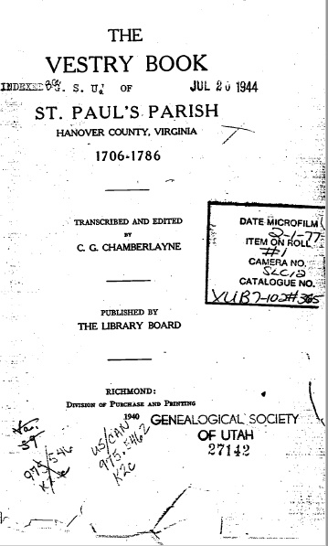
Knowing the lands of Mr. John White helps us to understand more about his life.  However, this is not an easy task since most of the colonial wills and deeds for Hanover and New Kent Counties were unfortunately destroyed during the Civil War.  In order to learn about Mr. John White's lands, it is necessary to scour The Vestry Book of St. Paul's Parish, the principle source of land information for early Hanover and New Kent Counties. Cover of St. Paul's Parish Vestry Minute Book    T he first known procession of lands within St. Paul's Parish occurred in 1708/09.  The vestry divided the parish into smaller sections called precincts, and then ordered that a procession of the property boundaries within each precinct be carried out.  The land owners from a given precinct "walked" the boundary lines together confirming where one person's land ended and another's began.  When the procession was completed, a list of all the property owners within the...